


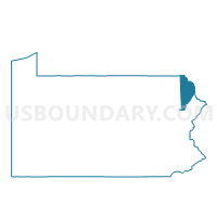
HONESDALE VTD 04, Wayne County, Pennsylvania
About
Outline

Summary
| Unique Area Identifier | 664368 |
| Name | HONESDALE VTD 04 |
| County | Wayne County |
| State | Pennsylvania |
| Area (square miles) | 0.76 |
| Land Area (square miles) | 0.75 |
| Water Area (square miles) | 0.01 |
| % of Land Area | 98.42 |
| % of Water Area | 1.58 |
| Latitude of the Internal Point | 41.56135720 |
| Longtitude of the Internal Point | -75.25390290 |
Maps


Graphs
Select a template below for downloading or customizing gragh for HONESDALE VTD 04, Wayne County, Pennsylvania


Neighbors
Neighoring Voting District (by Name) Neighboring Voting District on the Map
- HONESDALE VTD 01, Wayne County, PA
- HONESDALE VTD 03, Wayne County, PA
- TEXAS TWP VTD 01, Wayne County, PA
- TEXAS TWP VTD 02, Wayne County, PA